Data Description
National Elevation Dataset 1999 (raster)
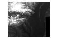
Data available online through GeoStor at http://www.geostor.arkansas.gov. The U.S. Geological Survey has developed a National Elevation Database (NED). The NED is a seamless mosaic of best-available elevation data. The 7.5-minute elevation data for the conterminous United States are the primary initial source data. In addition to the availability of complete 7.5-minute data, efficient processing methods were developed to filter production artifacts in the existing data, convert to the NAD83 datum, edge-match, and fill slivers of missing data at quadrangle seams. One of the effects of the NED processing steps is a much-improved base of elevation data for calculating slope and hydrologic derivatives.
[Keywords: elevation surface model dem ]


