Data Description
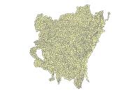
WBD HU COMBINED 2010 (polygon)
This data set is a complete digital hydrologic unit boundary layer to the Subwatershed (12-digit) 6th level for the State of Arkansas. This data set consists of geo-referenced digital data and associated attributes created in accordance with the “FGDC Proposal, Version 1.0 – Federal Standards For Delineation of Hydrologic Unit Boundaries 3/01/02″(http://www.ftw.nrcs.usda.gov/huc_data.html). Polygons are attributed with hydrologic unit codes for 4th level sub-basins, 5th level watersheds, 6th level subwatersheds, name, size, downstream hydrologic unit, type of watershed, non-contributing areas and flow modification. Arcs are attributed with the highest hydrologic unit code for each watershed, linesource and a metadata reference file.
[Keywords: HUC Hydrologic Units Hydrologic Unit Code Region Sub-region Basin Sub-basin Watershed Watershed Boundaries boundaries Subwatershed WBD Watershed Boundary Dataset inlandWaters NRCS ]


