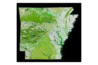
Data Description
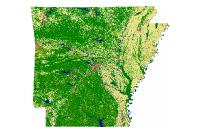
Landcover GAP 30M 1993 (raster)
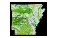
Data available online through GeoStor at http://www.geostor.arkansas.gov. This layer depicts 38 UNESCO/TNC based landcover categories for the State of Arkansas, which were derived from a digital classification of Landsat Thematic Mapper (TM) imagery, mostly from 1992. This data is not aggregated and is presented in the original pixel-level classification. Categories: 1:T.1.A.9.b.I Pinus echinata shortleaf pine 2:T.1.A.9.b.II Pinus taeda loblloly pine 4:T.1.A.9.c.I Juniperus virginiana eastern red cedar 6:T.1.B.2.b.I Quercus spp. – Pinus echinata – Carya spp. (uplands – dry) oak – shortleaf pine – hickory (uplands – dry) 8:T.1.B.2.b.III Pinus taeda – – Pinus echinata – Quercus spp. (lowlands) loblloly pine – shortleaf pine – oak (lowlands) 9:T.1.B.2.b.IV Juniperus virginiana eastern red cedar 10:T.1.B.3.a.I Fagus grandifolia american beech 11:T.1.B.3.a.II Quercus alba – mixed hardwoods white oak – mixed hardwoods 12:T.1.B.3.a.III Quercus rubra – Quercus spp. northern red oak – mixed oaks 13:T.1.B.3.a.IV Quercus falcata – Quercus spp. southern red oak – mixed oaks 14:T.1.B.3.a.V Quercus stellata post oak 17:T.2.A.2.b.I Juniperus virginiana – Quercus spp. eastern red cedar – mixed oaks 18:T.2.B.3.a.I Pinus echinata – Quercus spp. shortleaf pine – mixed oaks 19:T.2.B.3.a.II Juniperus ashei – Quercus spp. white cedar – mixed oaks 20:T.2.B.4.a.I Quercus spp. – Carya texana oak – hickory (black) 23:T.4.B.3.a.II Vaccinium spp. – Crataegus spp. mixed shrub 24:T.5.A.1.a.I Tripsacum dactyloides – Panicum virgatum – Andropogon spp. tall mesic prairie 32:P.1.B.3.c.I Quercus lyrata – Carya aquatica – Quercus spp. overcup oak – water hickory – mixed oaks 33:P.1.B.3.c.II Carya aquatica – Faxinus pennsylvanica – Quercus lyrata water hickory – white ash – overcup oak 34:P.1.B.3.c.III Quercus falcata var. pagodifolia – Quercus spp. cherrybark oak – mixed oaks 35:P.1.B.3.c.IV Celtis laevigata – Faxinus spp. – Carya spp. sugarberry – mixed ash – mixed hickory 36:P.1.B.3.c.V Quercus nuttallii (texana) – Quercus spp. – Fraxinus spp. nutall oak – mixed oaks – mixed ash 38:P.1.B.3.c.VII Quercus phellos – Quercus spp. – Carya spp. willow oak- mixed oaks – mixed hickory 39:P.1.B.3.c.VIII Liquidambar styraciflua sweetgum 40:P.1.B.3.d.I Taxodium distichum – mixed hardwood baldcypress – mixed hardwoods 41:P.1.B.3.d.I.1.a. Taxodium distichum baldcypress 42:P.1.B.3.d.II Nyssa aquatica -Taxodium distichum – Nyssa spp. water tupelo – bald cypress – tupelo 45:P.5.A.4.a.I Tripsacum dactyloides – Panicum virgatum tall prairie (moist to wet) 48:P.5.A.4.b.III Arundinaria gigantea tall prairie (disturbed) 51:R.1.B.3.c.I Salix spp. – Populus spp. mixed willows – mixed cottonwoods 52:R.1.B.3.c.II Betula nigra – Platanus occidentalis – Acer saccharinum river birch – american sycamore – sugar maple 55:R.6.A.1.a.I Bare bare 60:Water 61:Agriculture (wet crops) 62:Agriculture (dry crops) 63:Agriculture (pasture) Agriculture (pasture) 64:Urban Commercial/Industrial 65:Urban Residential
[Keywords: imageryBaseMapsEarthcover lulc land use cover ]

