Data Description
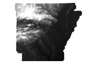
Image Service created from the 2006 Five Meter DEM. The source product can be found here (http://gis.arkansas.gov/?product=2006-five-meter-resolution-digital-elevation-model-raster-new)
THIS IMAGE SERVICE IS NOT HYDROLOGICALLY ENFORCED AND IS NOT SUITABLE FOR SITE DESIGN, HYDROLOGIC DESIGN OR ANALYSIS
More information on the 5 Meter DEM accuracy can be found here: http://gis.arkansas.gov/Docs/ELEVATION_ONE_PAGER.pdf
Below you will find the REST endpoint for the Image Service:
http://gis.arkansas.gov/arcgis/rest/services/ImageServices/5M_DEM_STATEWIDE_2006/ImageServer
[Keywords: elevation surface model dem ]


