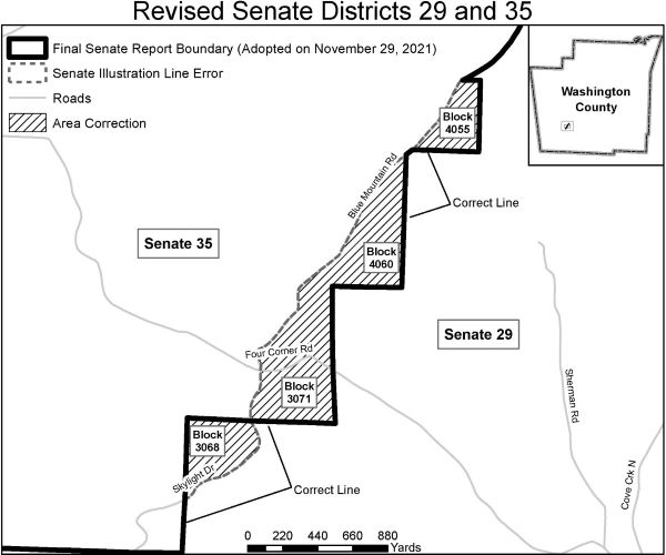
DATA CORRECTION: Senate Districts Adopted 2021
During a quality control process related to the submission of new Senate District boundaries to the U.S. Census Bureau an error was discovered by Arkansas GIS staff. This revised publication corrects that error. For additional details regarding the nature of the corrections please read below. The official notice regarding these corrections can be found here.
The GIS Office misinterpreted two sections of the Senate report adopted by the Board of Apportionment when preparing the Senate map. This created an error in the map between Senate District 29 and Senate District 35, in southwest Washington County. The map below shows the affected area. The adopted report serves as the legal description of the Senate Plan.