Data Description
NAIP Imagery 2013 (raster)
ATTENTION – ACCESS THIS IMAGERY AS A WEB SERVICE: http://gis.apfo.usda.gov/arcgis/rest/services/NAIP/Arkansas_2013_1m/ImageServer
What is NAIP?
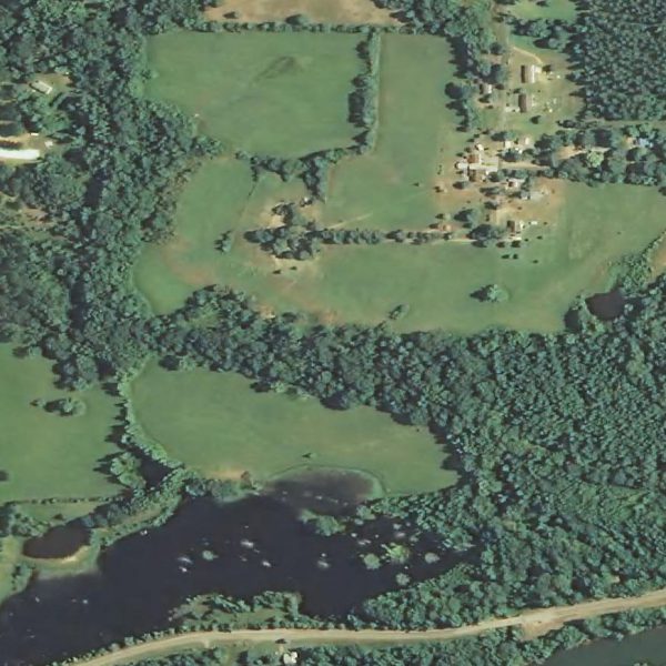
The National Agriculture Imagery Program (NAIP) acquires aerial imagery during the agricultural growing seasons in the continental U.S. A primary goal of the NAIP program is to make digital ortho photography available to governmental agencies and the public within a year of acquisition.
NAIP is administered by the USDA’s Farm Service Agency (FSA) through the Aerial Photography Field Office in Salt Lake City. This “leaf-on” imagery is used as a base layer for GIS programs in FSA’s County Service Centers, and is used to maintain the Common Land Unit (CLU) boundaries.
How can NAIP be used?
NAIP is used by many non-FSA public and private sector customers for a wide variety of projects. A detailed study is available in the Qualitative and Quantitative Synopsis on NAIP Usage from 2004 -2008: Click here for a list of NAIP Information and Distribution Nodes.
When is NAIP acquired?
NAIP projects are contracted each year based upon available funding and the FSA imagery acquisition cycle. Beginning in 2003, NAIP was acquired on a 5-year cycle. 2008 was a transition year, and a three-year cycle began in 2009. Click here >> for an interactive status map of NAIP acquisitions from 2002 – 2014.
What are NAIP Specifications?
NAIP imagery is acquired at a one-meter ground sample distance (GSD) with a horizontal accuracy that matches within six meters of photo-identifiable ground control points, which are used during image inspection.
The default spectral resolution is natural color (Red, Green and Blue, or RGB) but beginning in 2007, some states have been delivered with four bands of data: RGB and Near Infrared
Contractually, every attempt will be made to comply with the specification of no more than 10% cloud cover per quarter quad tile, weather conditions permitting.
All imagery is inspected for horizontal accuracy and tonal quality.
[Keywords: Aerial Ortho Orthos Photos Photography Aerials Aerial Photos Ortho Photos Aerial Photo Ortho Photo Aerial Photography Ortho Photography Imagery Image Aerial Imagery Orthoimagery National Agriculture Imagery Program NAIP]

