
To ensure that our users are able to fully leverage the GeoStor platform’s ArcGIS Server functionality here are the instructions to connect to GeoStor’s ArcGIS Server instance to consume and display Map & Feature Services dynamically. Please keep in mind there are limits set on how many features return so services with many features will be best viewed at large scales.
A simple Video tutorial can be viewed on Youtube at https://www.youtube.com/watch?v=0-tuAfLqoos
Also detailed instructions are as followed:
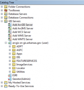
- Open ArcCatalog
- Expand “GIS Servers”
- Click Add ArcGIS Server
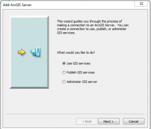
- Click Next
- Put this URL in for the Server URL: https://gis.arkansas.gov/arcgis
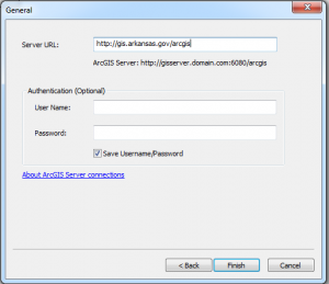
- Click Finish
Setting this up will allow you to use ASDI’s GeoStor ArcGIS Server published Feature, Map, Image and Locator services which means you no longer have to download an updated version of previously downloaded data.
For web developers, the ArcGIS Server services can be consumed via the REST or SOAP API’s. The service directory is accessible at https://gis.arkansas.gov/arcgis/rest/services/
